 11
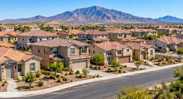
If you drive Hunt Highway or the stretch of Gantzel Road near the commercial corners, the answer to what are they building in San Tan Valley arrives in a long list of dust fences and graded pads. Pinal County planning records and the town of Queen Creek’s sphere of influence maps lay out a pipeline dominated by single family subdivisions.
A growing roster of industrial and logistics buildings near the Hunt Highway industrial corridor, and a slow but real wave of retail and service commercial tied to new rooftops. The short version: residential leads, commercial follows, and the infrastructure catching up underneath both is the story most people miss.
San Tan Valley is not an incorporated city. It is an unincorporated community spanning roughly the eastern edge of Pinal County, bordered by Queen Creek to the west and Florence to the east. That legal status shapes every answer to the question of what are they building in San Tan Valley, because land use decisions run through Pinal County’s planning department rather than a single municipal building counter.
Developers file with the county, the county coordinates with utility districts and the state land department, and residents read the results through public hearing agendas instead of a town council vote.
The overwhelming bulk of active construction here is housing. The U.S. Census Bureau classifies San Tan Valley as a census designated place, and the population figures attached to that designation tell the story faster than any sales brochure.
Earlier census counts put the community above 80,000 residents, and that number reflects roughly a decade of continuous residential permitting rather than any single development cycle. You can pull the population and housing unit tables directly from the Census Bureau QuickFacts entry for San Tan Valley CDP and watch the housing unit count climb against the population base.
What that means in physical terms is that a large share of the open desert between Hunt Highway and the Gila River corridor has been platted into master planned communities. Builders like Fulton Homes, Meritage, Taylor Morrison, and Shea Homes have all carried product here, and the model is consistent: phased subdivisions with a community center, a pool, and sometimes an elementary school pad.
Each phase generates its own permits, its own traffic study, and its own set of grading and drainage plans filed with the county. When people ask what are they building in San Tan Valley and expect a single project name, the honest answer is that there are dozens running simultaneously.
The mix skews toward entry level and move up single family detached homes, with a smaller slice of build to rent and townhome product appearing in the newer plats. Build to rent arrived here later than in the East Valley core, but it is present, and it shows up in the form of horizontal apartment style communities with individual entries rather than the vertical complexes you see closer to Phoenix.
| Category | What It Looks Like on Site | Where It Concentrates
|
|---|---|---|
| Single family subdivisions | Graded lots, model homes, phased platting | Hunt Highway corridor, Gantzel Road, Schnepf Road edges |
| Build to rent | Horizontal units, individual driveways | Near commercial nodes, arterial frontage |
| Retail and service commercial | Pad buildings, grocery anchored centers, fuel and convenience | Hunt Highway and Gantzel intersections |
| Industrial and logistics | Tilt wall shells, truck courts, yard storage | Hunt Highway industrial corridor, rail and highway adjacency |
| Public and institutional | School pads, fire stations, utility yards | Inside master plans and along arterials |
Commercial construction lags residential by a predictable margin, and San Tan Valley is in the middle of that lag closing. Retail follows rooftops, and the rooftops have arrived in enough density that grocery anchored centers, fuel stations, and quick service pads are now viable where they were marginal five years ago.
The eastern commercial corners along Hunt Highway and Gantzel Road are the visible evidence, and anyone wondering what are they building in San Tan Valley should look there first on a Saturday because the parking lots will tell you which tenants committed. Successful commercial developments also depend on understanding how to design a building that meets local zoning, functionality, and infrastructure requirements.
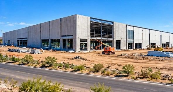
The industrial side is less visible to daily commuters but larger in square footage. The Hunt Highway industrial corridor and the land toward the Florence Junction side have attracted warehouse and light industrial shells, some built on spec and some build to suit.
Pinal County has tracked this growth through its planning and zoning dockets, and the county’s own Planning and Zoning department page is where the hearing agendas and case files live. If you want to know what are they building in San Tan Valley on a specific parcel, that page is the primary source most residents never open.
The draw is highway access and land basis. The Hunt Highway alignment connects to the broader East Valley grid, the land is cheaper than comparable acreage inside Maricopa County, and Pinal County has been willing to approve industrial entitlements that would draw more friction closer to Phoenix.
Logistics tenants care about distance to the I-10 and Loop 202 interchanges more than they care about municipal branding, and San Tan Valley sits close enough on both counts to stay in the conversation.
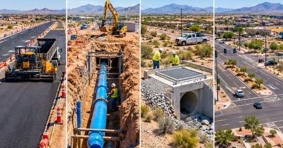
The least glamorous answer to what are they building in San Tan Valley is the utility and road work that most residents only notice when it slows their commute. San Tan Valley sits in the service territory of Johnson Utilities historically, and the transition to EPCOR as the water and wastewater provider reshaped how development approvals get sequenced.
Water and wastewater capacity is the binding constraint on new subdivisions here, not land availability, and builders cannot pull permits for a phase until the utility confirms capacity and the county confirms the improvement plans.
Road work follows the same logic. Hunt Highway, Gantzel Road, Schnepf Road, and the Ironwood Drive connector all carry widening and intersection improvement projects that appear on Pinal County’s transportation capital plans and on the Pinal Regional Transportation Authority’s project lists.
The PRTA was established through a voter approved county transportation tax, and the funded project list is public through the authority’s own reporting. Anyone tracking what are they building in San Tan Valley over the next five years should read that list line by line, because the road widening schedule predicts which commercial corners open next.
The EPCOR transition matters because utility service areas do not follow postal boundaries. A subdivision on the east side of the community may be on a different wastewater arrangement than one closer to Queen Creek, and the capacity agreements behind each one determine whether vertical construction starts this year or three years from now.
Builders who understand this file early in the entitlement process and coordinate with the utility’s engineering group before final plat recording consistently move faster than those who do not.
School pads appear inside master planned communities as part of the development agreement, and the districts serving San Tan Valley, primarily J.O. Combs Unified and Florence Unified, have both built new elementary and middle school capacity in response to enrollment growth.
Fire and emergency medical facilities follow the same pattern through the regional fire districts. These projects rarely make the news cycle in the way a new subdivision does, but they are part of what are they building in San Tan Valley on any given month and they consume a real share of the construction labor pool in the area.
Parks and county facilities fill out the institutional category. Pinal County has invested in regional park improvements and in the county’s own facilities planning, and the community’s unincorporated status means some of what functions as a local park is actually a county or school district asset.
When you read a construction sign near a ballfield, check the owner line on the permit rather than assuming a developer is behind it.
The method is unglamorous and it works. Start with the parcel number from the county assessor’s map, then pull the zoning case history and the active building permits attached to that parcel number.
Pinal County publishes its permit and planning records through its online portals, and the staff at the planning counter will walk a resident through the search if the portal cooperates, which it sometimes does not. The zoning case number is the key artifact because it names the applicant, the requested use, and the hearing date in one document.
For anything larger than a single lot, the hearing agenda is more useful than the permit record. Agendas describe the entire project narrative, including the requested density, the infrastructure commitments, and the conditions of approval that the developer agreed to in exchange for the rezoning.
Read the conditions section carefully because that is where the promises about setbacks, buffering, and road improvements live, and those conditions are legally binding on the developer in a way that a marketing website is not.
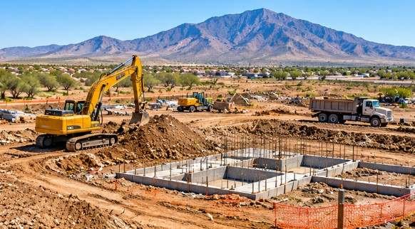
On the ground, the site tells you a lot before you ever open a portal. Grading without vertical construction means the project is in the infrastructure phase, which can last a full season. Tilt wall panels staged on a pad mean an industrial or commercial shell is going vertical.
Foundations with no framing yet usually mean the subdivision is recording final plats phase by phase. A construction trailer with a site plan taped to the window is the single best free source of information on any active project, and nobody minds if a curious neighbor reads it from the public right of way.
The direction of construction in this community is set by the land that has already been entitled, not by what breaks ground this quarter. Pinal County has approved enough residential entitlements on the eastern side of the community that the housing pipeline runs for years regardless of short term market conditions, and the commercial and industrial construction will continue to trail those rooftops by a year or two at each node.
The constraint that matters is water and wastewater capacity, followed closely by road capacity on Hunt Highway and Gantzel Road. Builders and developers who track those two variables will know what are they building in San Tan Valley two years before the neighbors do.
For a contractor working in this market, the practical implication is that scopes will keep shifting toward infrastructure adjacent work, utility coordination, and phased residential finish out rather than single large projects. The community is mid build, the entitlements are already recorded, and the next visible wave will be commercial pads catching up to the subdivisions that landed between 2015 and 2023.